Unlock ROI with optimized sales territory management
Uncover more opportunities in every territory. Manage large areas efficiently, scale your field sales operations, and capture the insights you need to drive profitable growth.
Plan territories that convert
Divide and conquer with precise territory management
Create and assign custom territories in moments. Reach more prospects, identify the best opportunities, and focus on high-conversion areas to maximize ROI.
- Ensure every door gets knocked, even in large territories
- Prioritize the doors most likely to convert
- Manage who works what and when with tight territory control and time-bound lists
Maximize productivity
Keep reps on track and on target
Help reps do what they do best. Eliminate double knocking and territory confusion, and give each rep a clear path to success with data-driven mapping and assignments.
- Give reps clear ownership areas to drive accountability and motivation
- Provide rich lead data across each territory for personalized selling
- Reduce travel time and knock more doors with up to 200 stops per route
Prove impact
Prove ROI for every territory
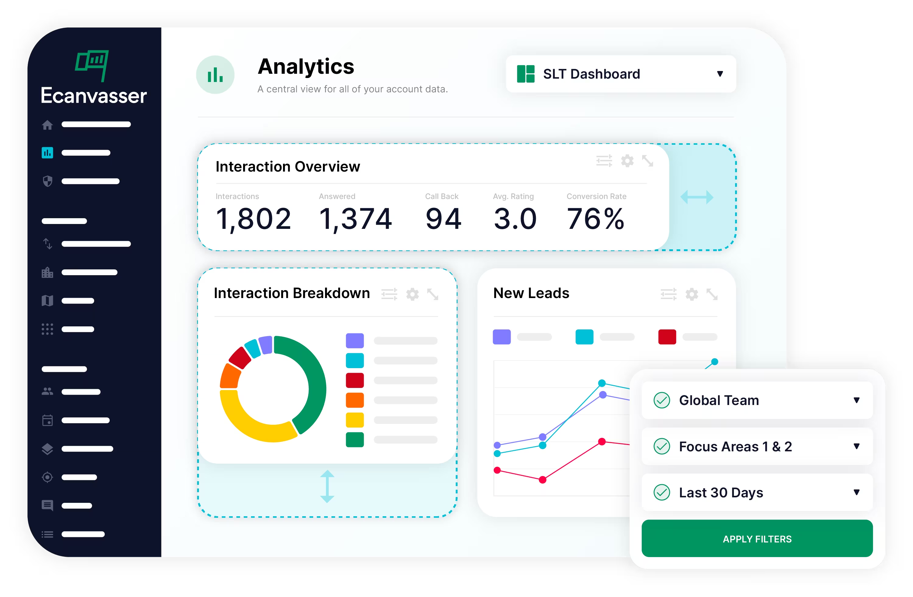
Measure, and increase, ROI for every territory with database pricing and robust analytics. Easily forecast software costs, strategically manage your budget, and demonstrate the impact of your field sales operations on your business’s bottom line.
- Database pricing allows you to grow profitably as your market expands
- Drive sustainable growth for each territory, instead of wasting time managing seats or losing insights when reps move on
- Visualize progress and measure ROI per door knocked with in-depth territory analytics
Grow without friction
Scale to new territories without adding complexity
Ecanvasser is built to grow with your business. Tackle large territories, manage multi-region teams, and maintain visibility and control even as you scale - without adding complexity.
- Easy to use for both reps and managers, reducing onboarding time for new hires and minimizing the impact of turnover
- Maintain tight territory control and oversight as you grow with multi-account workspaces
- Keep doing what works: Ecanvasser integrates with your existing systems and CRM so you don’t need to change your processes
Frequently Asked Questions
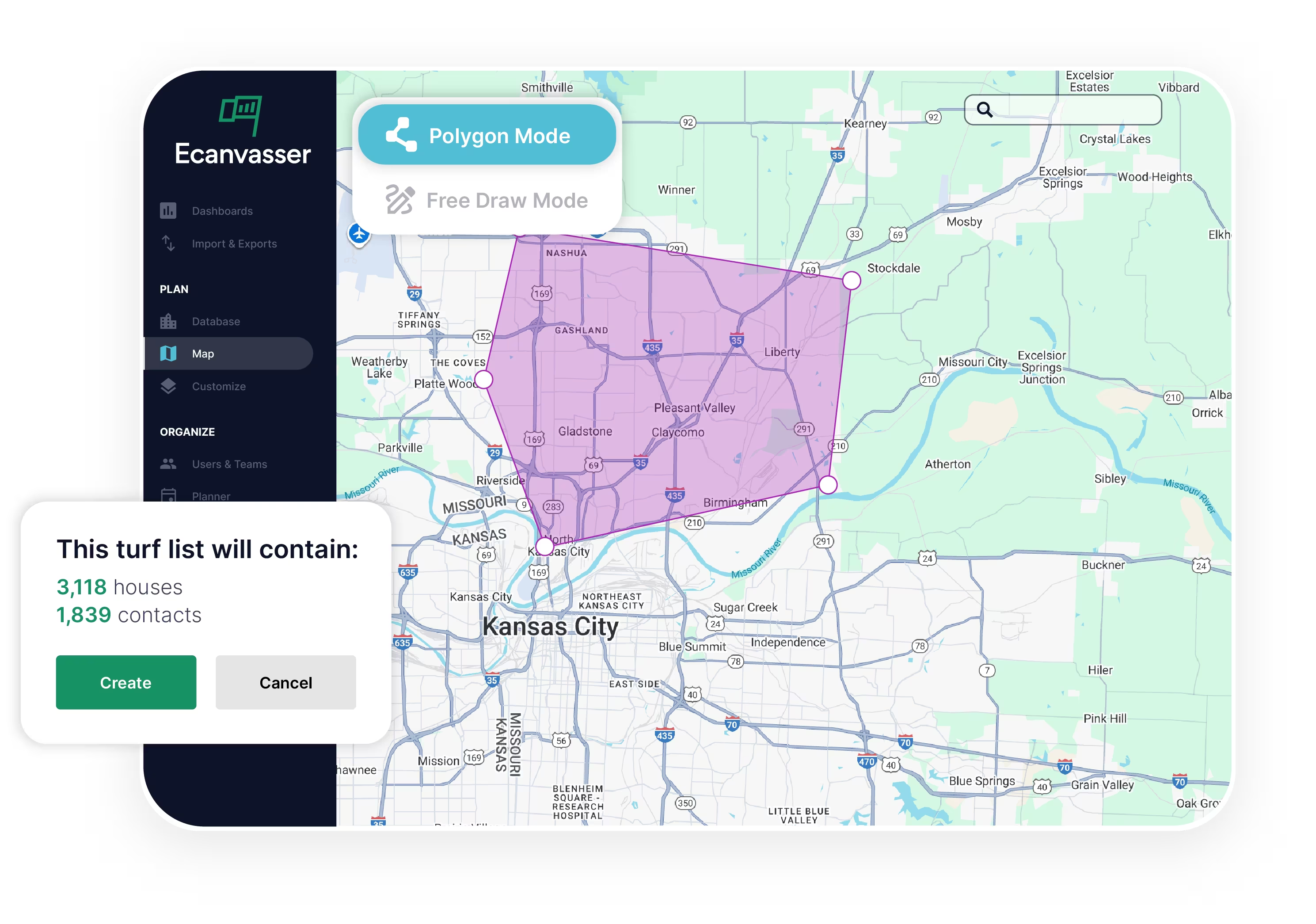
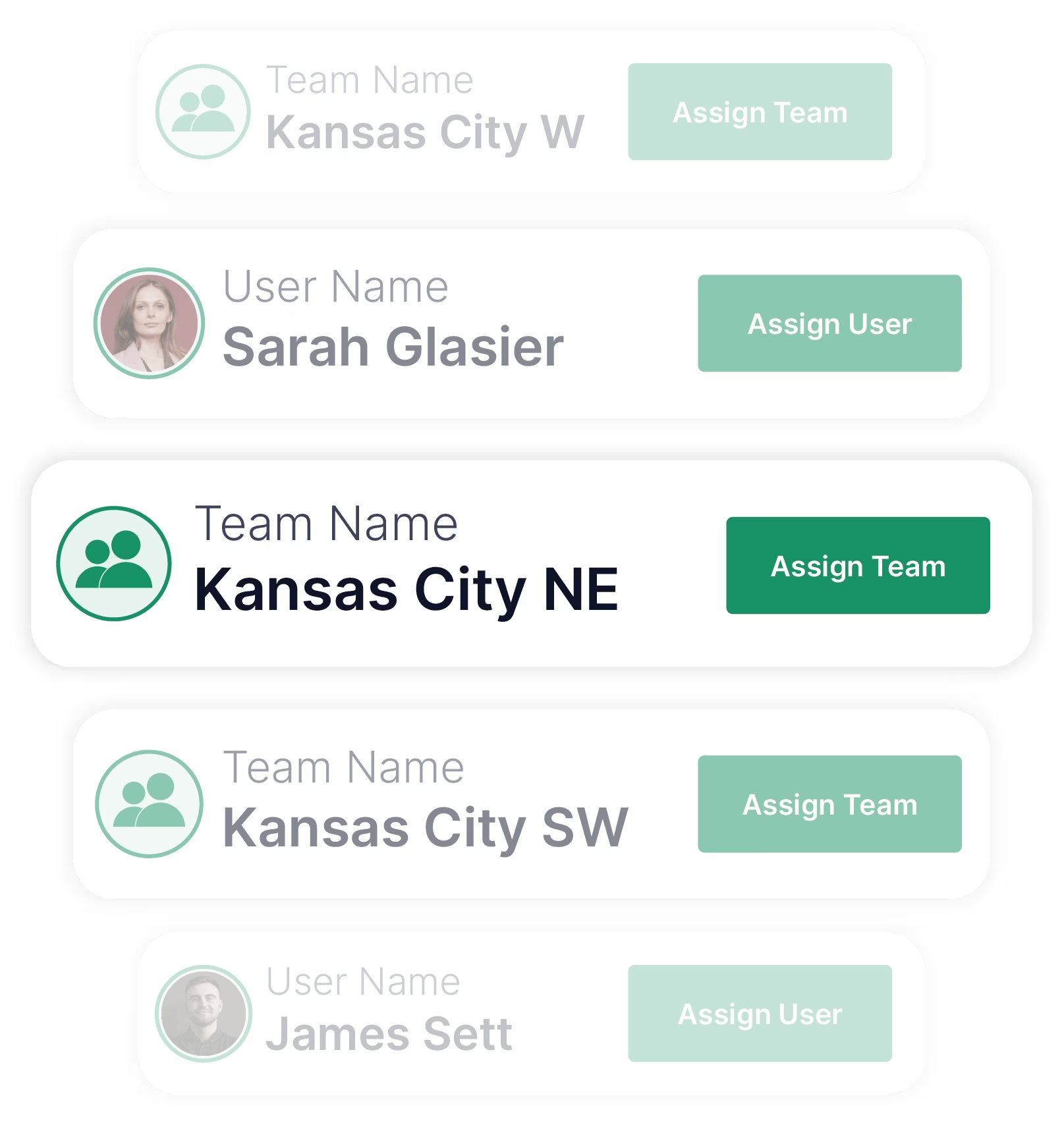
Import your contacts, plan and draw your territory, then assign to reps or teams. Territories sync to reps’ mobile devices where they can easily plan routes, record interactions, and book follow up appointments.
Territory mapping helps eliminate overlap, balance workloads, and ensure full coverage, helping sales teams be more efficient and productive.
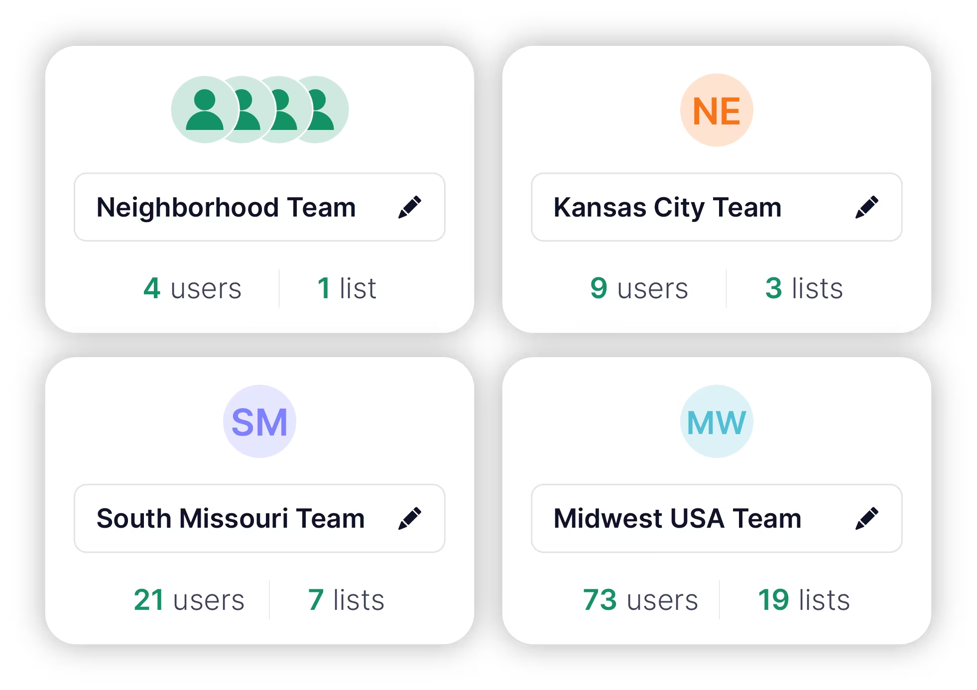
Yes. Ecanvasser has a multi-workspace structure that allows you to manage regions separately but maintain complete oversight over all territories with a consolidated global view.
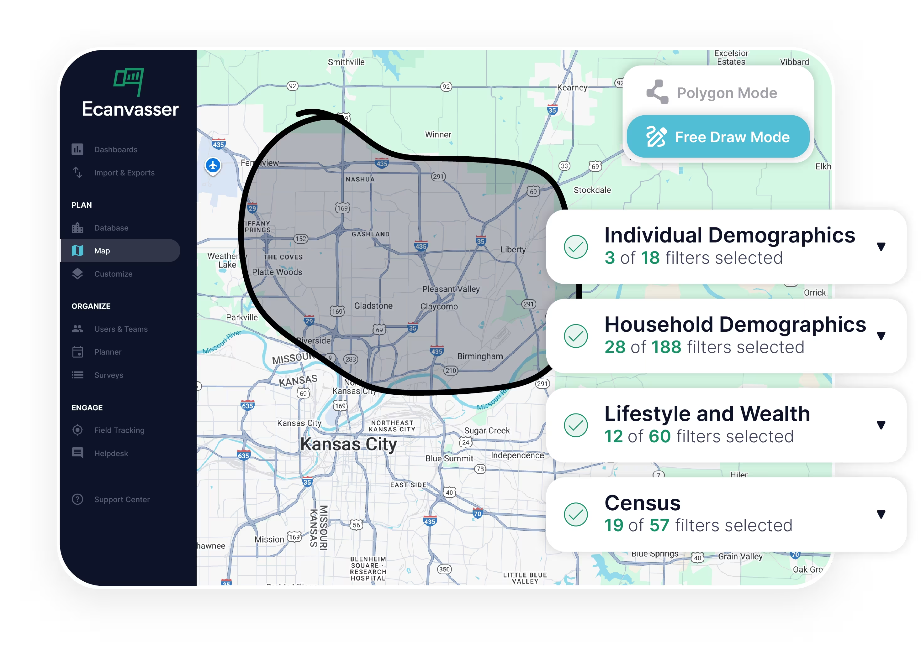
Yes, you can layer in external data using shapefiles to enhance your territory mapping and planning capabilities.You can then automatically create territories from those shapefiles.
Once drawn, territories automatically become Lists that you can assign to teams, keeping your workflow organized.
Absolutely. Ecanvasser supports editable territory points, so you can tweak existing boundaries to include or exclude specific areas.
Only the addresses currently visible on the Map and matching your active filters will be included, ensuring that your territory reflects exactly what you need.
Ecanvasser offers both Polygon (click-to-point) and Free Draw modes to define your territory with precision and flexibility.